Your Guide to the Neighborhoods of Florence Township, NJ: Florence Roebling and the Country
Published | Posted by Dennis Mark Interdonato
- Florence NJ
- Roebling NJ
- Burlington County
- Neighborhood Guide
- Real Estate
Florence Township covers the northern edge of Burlington County along the Delaware River, and inside its borders are places that feel like separate towns. There is Florence, a riverfront grid that began as a planned town in 1849. There is Roebling, a steel company's village built from 1905. And south and east of Route 130 there is what the township's own planning vision calls "the Country," where newer subdivisions give way to farmland and the old crossroads of Bustleton. This guide from Dennis Mark Interdonato of Keller Williams Realty Ocean Living compares them side by side: street patterns, the eras of the homes, where the parks and shops are, and how each one connects to the River Line and the highways.
Notable Neighborhoods in Florence Township at a glance
- Florence (the Town of Florence): the northwestern riverfront. A mid-1800s street grid, older homes close to the sidewalk, and the Broad Street shopping blocks. ZIP code 08518.
- Roebling (the Village of Roebling): the northeastern riverfront. A 1905 company town of rowhomes, twins and detached homes, most of it inside a National Register historic district. ZIP code 08554.
- Florence Station: the southeastern end of the Town of Florence, grown up along Delaware Avenue and Station Road around an old railroad stop.
- The Country, north of the Turnpike: subdivisions from the 1990s onward, including Mallard Creek, The Manors at Crossroads and the adult community Greenbriar Horizons.
- Bustleton and the southern township: farmland, woods and detached homes on large lots along the country roads.
Florence: the riverfront grid
Before it was Florence, this stretch of high riverbank was a farming settlement called High Banks. In 1849 the Florence City Company bought 600 acres, laid out a street grid starting with Front Street, and built a wharf, a hotel and brick houses to draw buyers. For a short time the new village was a summer resort a boat trip from Philadelphia. The company went bankrupt in 1854, and the town's next chapter came from industry: the Florence Iron Works opened on the riverbank in 1857, and after R. D. Wood bought the foundry in 1867, his company built 125 homes for employees along with the town's first water and sewer lines, commercial buildings and a library.
That history is still readable in the streets. The oldest part of town is a traditional grid running along Front Street and Delaware Avenue, with Broad Street carrying the original commercial buildings south from the river. Homes built after World War II in the eastern sections of town follow a looser, modified grid with some curving streets. If walking to the river and to the shops matters to you, the older grid near Broad and Front Streets is where to start looking.
Florence Station
Florence Station began as a stop on the Camden and Amboy Railroad and grew into its own corner of town. Homes and businesses spread along Delaware Avenue, north along Station Road, and south of the tracks toward the old Burlington Pike, which later became U.S. Route 130.
Roebling: a company town that is still intact
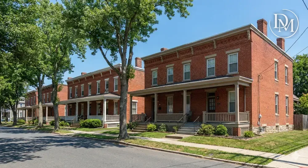
In 1904 John A. Roebling's Sons Company, the wire rope maker whose steel went into the Brooklyn Bridge, bought riverfront farmland in the township. There it built a steel mill called the Kinkora Works and, beginning in 1905, a planned village of 750 homes for the people who worked in it. Main Street ran from the mill's main gate through the village as its spine, with the first shops clustered at a roundabout. Rowhomes made up most of the housing. Semi-detached twins were built farther from the mill, and larger detached homes went up farther still, some of them along Riverside Avenue with views of the Delaware.
As the mill grew in the 1920s and 1930s, more rowhomes went up south of Hornberger Avenue and then south of the railroad, each on its own grid. After World War II, detached single-family homes filled in southward along Hornberger Avenue until Roebling met the houses spreading out from Florence.
The township's planning vision describes the original company-town housing as still intact, on grid streets with mature trees. The Roebling Historic District covers 76 acres with 94 contributing buildings in the Late Victorian style, and was listed on the National Register of Historic Places in 1978. The township's own plan refers to historic preservation regulations for the district, so if you are buying there, ask the township what applies to a specific address before you plan exterior changes to a facade, windows or porch.
The mill itself is gone. Steel production ended in 1981, the site went onto the federal Superfund list in 1983, and nearly all of the mill buildings were razed during the cleanup. The main gatehouse survived and opened in 2010 as the Roebling Museum.
The Country: newer subdivisions north of the Turnpike
Cross Route 130 heading south or east and the township changes character. North of the New Jersey Turnpike Extension, most of the housing is low-density subdivisions on curving streets, laid out around wetlands, floodplains and open space. The names you will see most often in listings:
- Mallard Creek: several hundred detached single-family homes from the late 1990s and early 2000s, reaching in from Route 130 between Crafts Creek and one of its tributaries.
- The Manors at Crossroads: mostly detached single-family homes built between 2008 and 2010, on the northeast side of Florence-Columbus Road (County Route 656).
- Greenbriar Horizons: an age-restricted adult community of detached homes built in the mid-2000s, entered from Old York Road by Lubrano Lane or Yockus Lane. It lies partly in Florence Township and partly in Bordentown Township, and its listed amenities include a clubhouse, pool, tennis courts and walking paths.
Older detached homes on large lots also line parts of Potts Mill Road, many of them on private septic systems. One detail that surprises buyers here: some homes in this part of Florence Township carry a Bordentown mailing address (ZIP 08505), even though they sit in Florence Township. The mailing address and the municipality are not always the same, so check the township on the tax record when you compare homes.
Bustleton and the southern township
South of the Turnpike Extension the land opens into farmland, woodland and open space, with detached homes on large lots along Old York Road and Burlington-Columbus Road. Bustleton, a crossroads settlement that was once a stagecoach stop, has houses from the mid-to-late 1800s alongside houses from the mid-to-late 1900s, on large lots along Old York Road, Bustleton Road and Florence-Bustleton Road. Public water and sewer are not the norm out here, so budget for a well and septic inspection on homes that use them.
Parks, trails and the river
- Roebling's waterfront: the former slag area along the river was cleaned up and turned into a waterfront park. The Delaware River Heritage Trail follows the top of the riverbank there. Burlington County opened its 5.5-mile Route 130 Bypass section of the trail in July 2021, running from Crystal Lake Park to the Roebling waterfront park, and it is part of the East Coast Greenway. The River Line's Roebling station gives the trail a rail stop.
- Township parks: the recreation department lists Veteran's Park, John A. Roebling Park, the Ezra "Bud" Marter Recreation Complex, Riverbank Park, H. Kenneth Wilkie Memorial Rivers Edge Park, Railroad Park and the FAAD Park.
- On the water in Florence: the township boat ramp on Front Street has a ramp, dock and trailer lot. Permits are required year-round.
History you can visit
The Roebling Museum at 100 2nd Avenue tells the story of the company town from inside the old mill gateway. A visit includes an introductory film, five-plus galleries and a 7-acre landscape with industrial equipment, and the mill's overhead crane-way and a large flywheel stand at the corner of Hornberger Avenue and Second Avenue. The museum is open March through December, Thursday to Saturday from 11am to 4pm, and runs a walking tour of the company town every Saturday at 1pm (not in January or February, or in rain, snow or heat over 90 degrees). Hours and prices change, so check the museum's site before you go. If you are weighing a home in Roebling, that Saturday walk is one of the best introductions to the streets you will find.
Shops and everyday errands
Each part of the township has its own shopping street. In Florence, the original commercial buildings are on Broad Street and parts of Delaware Avenue and Front Street. In Roebling, Main Street near the old mill gate was the first commercial center, and the southern part of the village has a short commercial stretch on Hornberger Avenue. Along Route 130, small-scale commercial sites cluster near the intersections with Florence-Columbus Road and with Cedar Lane and Florence-Bustleton Road, and the Shoppes at Mallard Creek is a small retail center where the township welcomed a new business in September 2026. Storefronts turn over, so Dennis Mark Interdonato can point you to what is open when you visit.
Getting around from each neighborhood
- River Line light rail: NJ Transit's River Line runs 34 miles between Trenton and Camden, with a station in each of the township's two historic centers. Roebling station is at 1499 Hornberger Avenue (215 parking spaces), and Florence station is off Route 130 on John Galt Way (589 spaces). At Trenton the line connects to NJ Transit's Northeast Corridor, Amtrak and SEPTA, and at Camden to the PATCO line into Philadelphia. The next stops are Bordentown to the north and Burlington Towne Centre to the south.
- NJ Transit bus: route 409 runs between Trenton and Philadelphia through the township.
- New Jersey Turnpike: the Pennsylvania Extension (I-95) crosses the township, with Exit 6A at Route 130.
- Route 130: the main road through the township, linking Mansfield Township to the northeast and Burlington Township to the southwest.
- I-295: crosses the southern end of the township. There is no interchange inside Florence Township, and the township plan points to Interchange 52 as the nearby access.
Large warehouse and distribution buildings have gone up around Exit 6A and along the southwestern stretch of Route 130 over the past 25 years. If a home backs toward the Turnpike or those industrial areas, drive past at a few different times of day to get a feel for truck traffic.
Frequently asked questions
Is Roebling its own town?
No. Roebling is a section of Florence Township, counted by the Census as its own census-designated place, with its own ZIP code (08554). Florence is the township's other census-designated place. Both share one township government.
Why does a Florence Township listing say Bordentown?
Some homes in the township, including parts of the Mallard Creek area, use a Bordentown mailing address with ZIP code 08505. The house is still in Florence Township. Confirm the municipality on the tax record, since that is what sets the tax rate and the public school district.
When can I tour the Roebling company town?
The Roebling Museum runs a walking tour of the company town every Saturday at 1pm from March through December, weather permitting. Tickets are sold at the museum's admission desk.
Find your part of Florence Township with Dennis Mark Interdonato
A rowhome a few blocks from the Roebling Museum, an older house on Florence's grid, and a 2000s colonial off Route 130 are all in the same township, and each comes with different questions about historic rules, septic, flood maps and commutes. Dennis Mark Interdonato of Keller Williams Realty Ocean Living can help you compare them street by street and tour the homes that fit your plans. Get in touch or call (732) 598-2672 to start your search.