How Deep Is the Water Off the Dock? Checking Depth, Tides and Bridge Clearance Before You Buy
Published | Posted by Dennis Mark Interdonato
- Waterfront
- Waterfront Homes
- Boating
- Home Buying
Check three things before you fall for a dock: the depth on a NOAA nautical chart, the tide predictions from NOAA Tides & Currents, and the clearance of every bridge between the house and open water. Then measure the water at the dock itself at low tide, because that's the number your boat lives with every day.
I'm Dennis Mark Interdonato with The Dennis Mark Group. Waterfront homes in Monmouth and Ocean County sit on ocean, bay, river and lagoon frontage, and the same boat can fit one dock and not the next. If a boat is part of the plan, it belongs in the house hunt from the first showing. Here's how to use the free federal tools that answer most of these questions.
What do the numbers on a nautical chart mean?
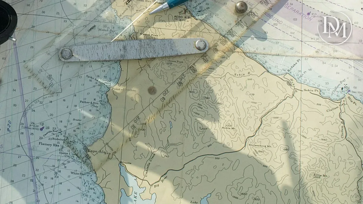
The small numbers across the water are soundings, the charted depths. NOAA's U.S. Chart No. 1, the guide to chart symbols, says the sounding datum is stated in the chart title, and the unit of depth, which can be feet, fathoms or meters, is shown in the title and outside the chart border in bold type. Read the title block before you read a single number.
On NOAA charts, that datum is Mean Lower Low Water. NOAA's tidal datum guide calls MLLW the reference datum for tide predictions, bench marks and nautical charting, and defines it as the average of the lower low water height of each tidal day over the National Tidal Datum Epoch, currently 1983 through 2001.
So a charted depth is roughly the water at an average low tide. Because MLLW is an average, some low tides drop below it, and the water at a dock can be shallower than the nearest sounding.
Where do you find the chart?
NOAA's Office of Coast Survey publishes electronic charts, called ENCs, that work on chart plotters and other electronic chart systems. Individual ENCs can be downloaded through NOAA's Chart Locator, and Coast Survey says ENCs downloaded directly from its websites are free (NOAA ENC). Chart No. 1 is free online too, so you can look up any symbol you don't recognize.
Charts are made for boats moving from place to place, so look at whether the chart shows soundings near the house at all. If it doesn't, the measurement at the dock is your answer.
How do tides change the depth at the dock?
NOAA's Tide Predictions service generates tide tables, the times and heights of daily high and low tides, for more than 3,000 locations around the country. Pick the station closest to the house and look at the lowest tides of the month, not an average day.
Know what predictions leave out. NOAA says it can only predict the astronomical tides and can't predict the effect of wind, rain, freshwater runoff and other short-term weather. It also notes that stations farther inland, along rivers, bays and other estuaries, tend to be more affected by wind than stations on the outer coast (NOAA Tides & Currents FAQ). Treat the prediction as a starting point, and leave room under the boat.
How do you check bridge clearance?
Every fixed bridge between the dock and open water sets a ceiling for the boat. On a NOAA chart, a bridge clearance is a height, and Chart No. 1 explains that planes of reference are usually defined in notes under the chart title. NOAA's chart-reading guide puts it plainly: to clear bridges and overhead cables, mariners refer to Mean High Water. When the tide runs above that reference, there's less room under the bridge than the chart shows.
The U.S. Coast Pilot, NOAA's series of nautical books, adds detail that's hard to show on a chart, including bridge and cable clearances. Every Coast Pilot volume is free to download, with updates published weekly.
Drawbridges have their own rules. The U.S. Coast Guard's drawbridge regulations say a drawbridge must open promptly and fully when a request or signal is given, except as the regulations otherwise allow (33 CFR Part 117). Many bridges have their own sections. The section for the New Jersey Intracoastal Waterway (33 CFR 117.733), for example, limits some openings to set times in season and requires advance notice for some overnight openings. Check the current rule for every drawbridge on your route.
How do you match the house to your boat?
- Know two numbers for your boat: its draft, how far it reaches below the waterline, and its air draft, how high it reaches above the waterline.
- Compare the draft with the water at the dock and along the route at the lowest tides you expect, with room to spare.
- Compare the air draft with the charted clearance of the lowest fixed bridge on the route, remembering that clearance shrinks as the tide rises.
- Measure at the dock at low tide with a sounding pole or a depth finder, or ask a marine contractor to do it during your inspection period.
- Map the whole trip from the dock to the bay or the ocean, including any drawbridge schedules.
Moving here with your boat? Registration and the boating safety certificate covers the State's rules for the boat itself.
What if the water at the dock is shallow?
Don't assume it can be dredged on your schedule. Dredging in tidal water needs an NJDEP permit, often a tidelands license and an approved place for the material. Lagoon dredging in New Jersey explains the permits and the questions to ask the town before you buy. Planning to add a lift instead? Read can you add a dock or boat lift after you buy.
When you're ready, search waterfront homes, see how I approach waterfront homes, and read how I help buyers. If you already own a home, start with what it's worth, and see selling and buying at the same time.
Frequently Asked Questions
Are depths on a NOAA chart measured at low tide?
They're measured from Mean Lower Low Water, which NOAA uses as the datum for nautical charting. It's an average of the lower low tides, so some low tides fall below it.
Where can I find tide times for a New Jersey waterway?
NOAA's Tide Predictions service covers more than 3,000 locations. The predictions are astronomical only, so wind and weather can push the water above or below them.
Is bridge clearance measured at high or low tide?
NOAA's chart guide says mariners refer to Mean High Water to clear bridges and overhead cables. Check the notes under the chart title for the reference used on that chart.
Do drawbridges open whenever a boat asks?
The Coast Guard's general rule is that they open promptly and fully on request or signal, but many bridges have their own schedules in 33 CFR Part 117. Check the section for each bridge on your route.
This is general information, not legal, insurance, engineering or lending advice. It doesn't replace a current chart, local notices or local knowledge on the water. Sources checked October 12, 2026.
About the author
Dennis Mark Interdonato is a REALTOR® and Master CDRE® who leads The Dennis Mark Group at Keller Williams Realty Ocean Living in Point Pleasant, NJ, helping buyers and sellers throughout New Jersey make their next move, with Monmouth and Ocean County as home base. Read more about Dennis Mark.
Keep reading
- Waterfront homes in New Jersey: what buyers should know before you buy
- Have a question this didn't answer? Send it to Dennis Mark and it may become the next article.